Tell your friends about this item:
Montana & Wyoming State Map Rand McNally
Our customers say:


Montana & Wyoming State Map
Rand McNally
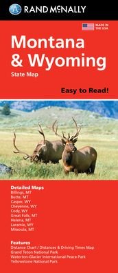
Rand McNally's Easy To Read State Folded Map is a must-have for anyone traveling in and around Montana and Wyoming, offering unbeatable accuracy and reliability at a great price. Our trusted cartography shows all Interstate, U. S., state, and county highways, along with clearly indicated parks, points of interest, airports, county boundaries, and streets. The easy-to-use legend and detailed index make for quick and easy location of destinations. You'll see why Rand McNally folded maps have been the trusted standard for years. -Regularly updated, full-color maps. - 48% larger map with a bigger type size than the Rand McNally Folded Map. - Clearly labeled Interstate, U. S., state, and county highways. - Indications of parks, points of interest, airports, county boundaries, and more. - Mileage and driving times map. - Detailed index. - Convenient folded size. Coverage Area: Detailed maps of Billings, MT; Butte, MT; Casper, WY; Cheyenne, WY; Great Falls, MT; Helena, MT; Missoula, MT; Waterton-Glacier International Peace Park, Yellowstone/Grand Teton National Parks.
| Media | Books Hardcover Book (Book with hard spine and cover) |
| Released | August 6, 2021 |
| ISBN13 | 9780528024566 |
| Publishers | Rand McNally |
| Genre | Maps & Guides |
| Dimensions | 150 × 220 × 20 mm · 500 g (Weight (estimated)) |
| Language | English |
More by Rand McNally
Show all


More from the same publisher

![Cover for Rand Mcnally · Rand Mcnally Providence Street Map (Paperback Book) [Map edition] (2020)](https://imusic.b-cdn.net/images/item/original/153/9780528008153.jpg?rand-mcnally-2020-rand-mcnally-providence-street-map-paperback-book&class=scaled&v=1512788431)
See all of Rand McNally ( e.g. Paperback Book , Map , Book , Hardcover Book and Spiral Book )