Tell your friends about this item:
Virginia State Map, Rand McNally


Virginia State Map, Rand McNally
Rand McNally
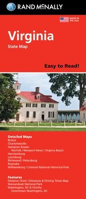
Rand McNally's folded map for Virginia is a must-have for anyone traveling in or through the state, offering unbeatable accuracy and reliability at a great price. Our trusted cartography shows all Interstate, U. S., state, and county highways and much more. Points of interest. State park chart. State mileage chart. Driving times map. On-the-road toolbox. Visitor center information. Climate data. State facts & symbols. Easy-to-use legend. Detailed indexed. Coverage Area: Detailed maps include, Alexandria/Arlington, Bristol, Charlottesville, Hampton Roads: Norfolk/Newport News/Virginia Beach, Lynchburg, Richmond/Petersburg, Roanoke, Shenandoah National Park, Washington, D. C. & Vicinity, Williamsburg/Colonial National Historic Park.
| Media | Books Hardcover Book (Book with hard spine and cover) |
| Released | September 22, 2021 |
| ISBN13 | 9780528025143 |
| Publishers | Rand McNally |
| Genre | Maps & Guides |
| Dimensions | 150 × 220 × 20 mm · 500 g (Weight (estimated)) |
| Language | English |
More by Rand McNally
Show all


Mere med samme udgiver


See all of Rand McNally ( e.g. Paperback Book , Map , Book , Hardcover Book and Spiral Book )